Introduction
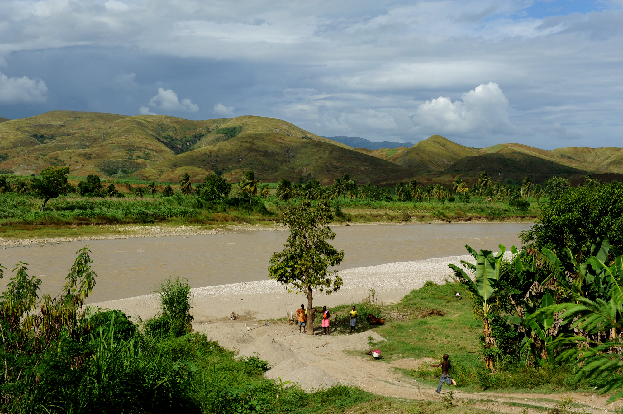
Image courtesy of Kendra Helmer, USAID via Wikimedia Commons
The epitome of poverty, Haiti makes for a fascinating study of urban and rural development, riparian ecology, and/or small-holder and subsistence agriculture. The poorest country in the Western Hemisphere, Haiti underwent tremendous deforestation in the 20th century, and very little forest cover remains. This has impacted the ecology and economy of the nation in dramatic ways. More recently, Haiti has suffered the misfortune of a crushing earthquake followed by a cholera outbreak that slowed the recovery. The case study itself is located around the capital of Port-au-Prince and the surrounding countryside. Riverine health is a topic of concern, given the treeless slopes and frequent hurricanes. Another issue is the continued weakness of the agricultural industry, as small-holder farmers struggle to achieve economic self-sufficiency and food security. Urban migration is high and has led to the rapid development of slums around the perimeter of the city.
As a case study, Haiti will require some life cycle assessment adaptatations due to its low-intensity farming methods. However, this is compensated for by more straightforward land cover and geospatial research possibilities. Of particular interest is Haiti’s continued dependence upon food aid, primarily from subsidized American farms. Be sure to check out the imagery for Haiti via Google Earth – it’s super high resolution imagery let’s you see individual trees!
Background
Energy/Resources: Energy Backgrounder Energy Profile Traditional Fuel Consumption Refurbish Hydro Plant Solar Energy and Briquettes Micro-Hydroelectric Power Wind Energy
Agriculture: Agricultural Overview Coffee Rice “Haitian farmers undermined by food aid” – Canada Haiti Action Network Sustainable Path for Coffee
Conservation/Ecology: Soil Conservation Efforts Reforestation Backgrounder including Agro-forestry Rising Tide Water Birds Resilience in Caribbean Countries
Society/Urban: Haiti Base Map Feeding Haiti Haiti’s Imported Disaster Cultural Recovery Haiti, Unfinished and Forsaken Over the Spread of Cholera in Haiti Health Benefits of Eating Mud Hurricane Sandy Destroys Harvests “Food dependency is poverty trap for quake-hit Haiti” – Reuters Driving the Seam of Hispaniola
Basic Geodata
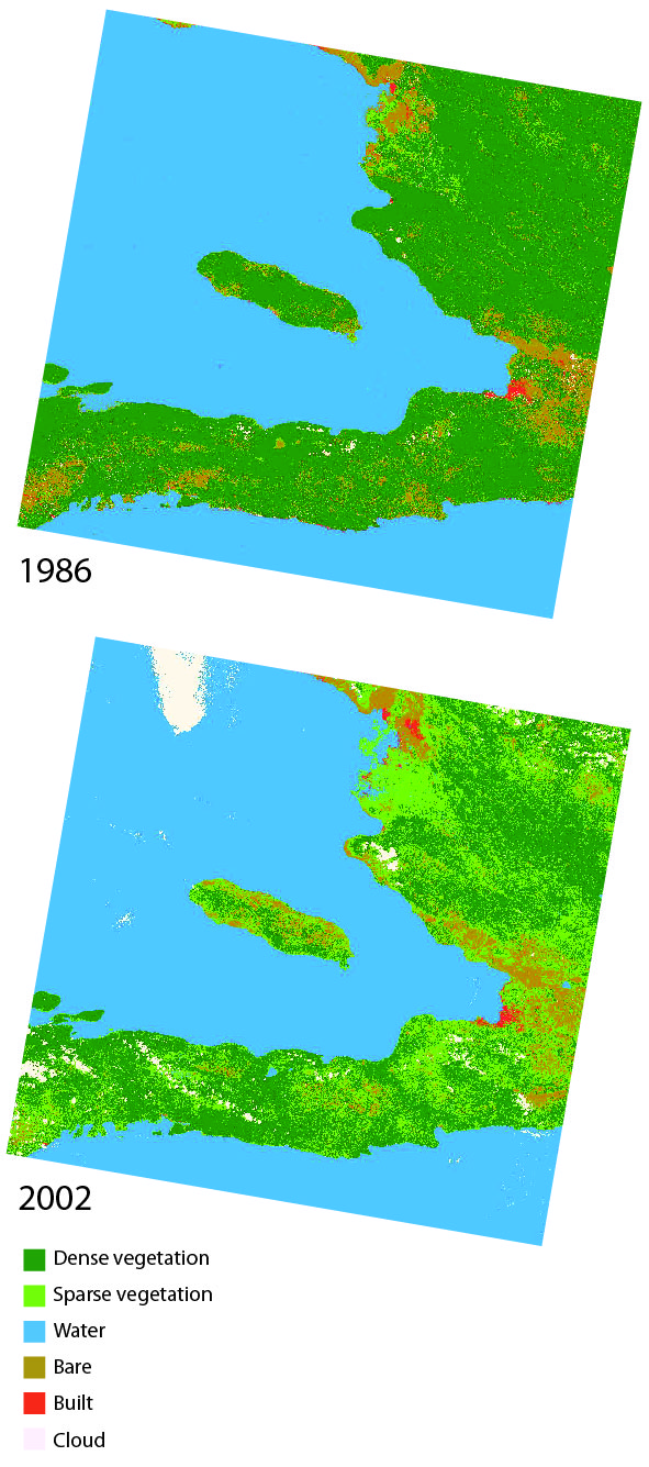
Land cover data (compatible with ArcGIS) will be provided to you in class, covering three past time periods since the 1980s. The links below will show you the approximate boundaries (as seen in Google Earth with recent years), as well as the basic changes in land cover.
view in Google Earth
Remember, in addition to Landsat-derived land cover, there are several more auxiliary geodata sets that have already been collected for you and will be provided in lab. These data include: terrain/elevation, nightlights which represent population, floristic zones, etc. and are available at all study locations. These datasets are introduced and explained further under Additional Data Sources. In addition to these ready-to-go, prepared auxiliary datasets, this page also provides ideas for additional datasets you might find on your own.