Introduction
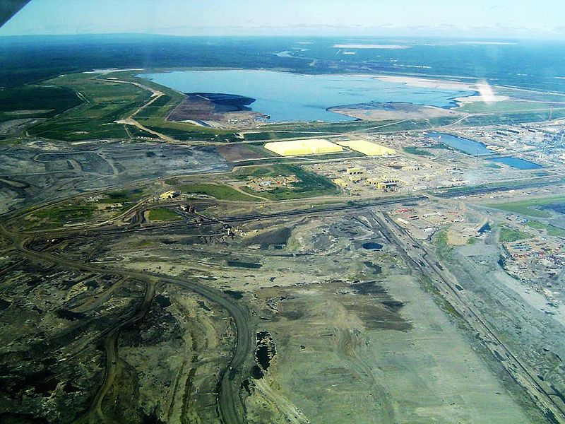
Image courtesy of TastyCakes via Wikimedia commons.
Fort McMurray is an interesting case studies for those interested in the oil sands, boreal forest loss, oil production using different technologies, and water toxicity. Fort McMurray is located in northeast Alberta, and home to the Athabasca Oil Sands. The area is the site of the recovery and extraction of oil sands using mining and in situ technologies, resulting in various environmental consequences. One can examine greenhouse gas emissions, water pollution and current restoration issues associated with the oil sands to make an interesting and complex project.
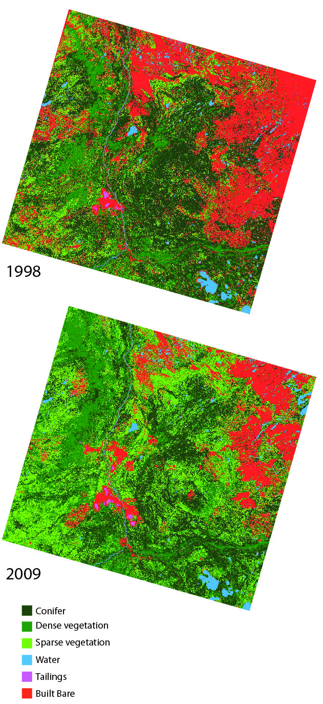
With the current environmental and social issues revolving around the oil sands, there is countless amount of information available about the subject. The only issue is the completeness and opacity of this information. Data sources can range from industry to government data to peer-reviewed literature and to ENGO’s. However, data values can differ greatly across these sources. Be sure to pay attention to where you get your numbers from and what assumptions the source has made about these numbers. The land cover data we have provided you is accurate for areas around oil sands, not Northeast part of image.
Background
Energy/Resources: Environment Alberta Alberta’s Oil Sands Pembina – Oil Sands Watch Canadian Association of Petroleum Producers World of Change Racing to Renewables in Fort McMurray Oil Crash
Conservation/Ecology: Mercury Pollution Canadian Oil Waste Groundwater in Athabasca Oil Sands Region Environmental Defence Syncrude Tailings Dam Higher Carcinogen Level Defusing the Carbon Bomb
Society/Urban: Policy about Tarsands George Hoberg on CBC
For an academic source: Be sure to check out the work of David Schindler
Basic Geodata
Land cover data (compatible with ArcGIS) will be provided to you in class, covering three past time periods since the 1980s. The links below will show you the approximate boundaries (as seen in Google Earth with recent years), as well as the basic changes in land cover.
view in Google Earth
Remember, in addition to Landsat-derived land cover, there are several more auxiliary geodata sets that have already been collected for you and will be provided in lab. These data include: terrain/elevation, nightlights which represent population, floristic zones, etc. and are available at all study locations. These datasets are introduced and explained further under Additional Data Sources. In addition to these ready-to-go, prepared auxiliary datasets, this page also provides ideas for additional datasets you might find on your own.