Introduction
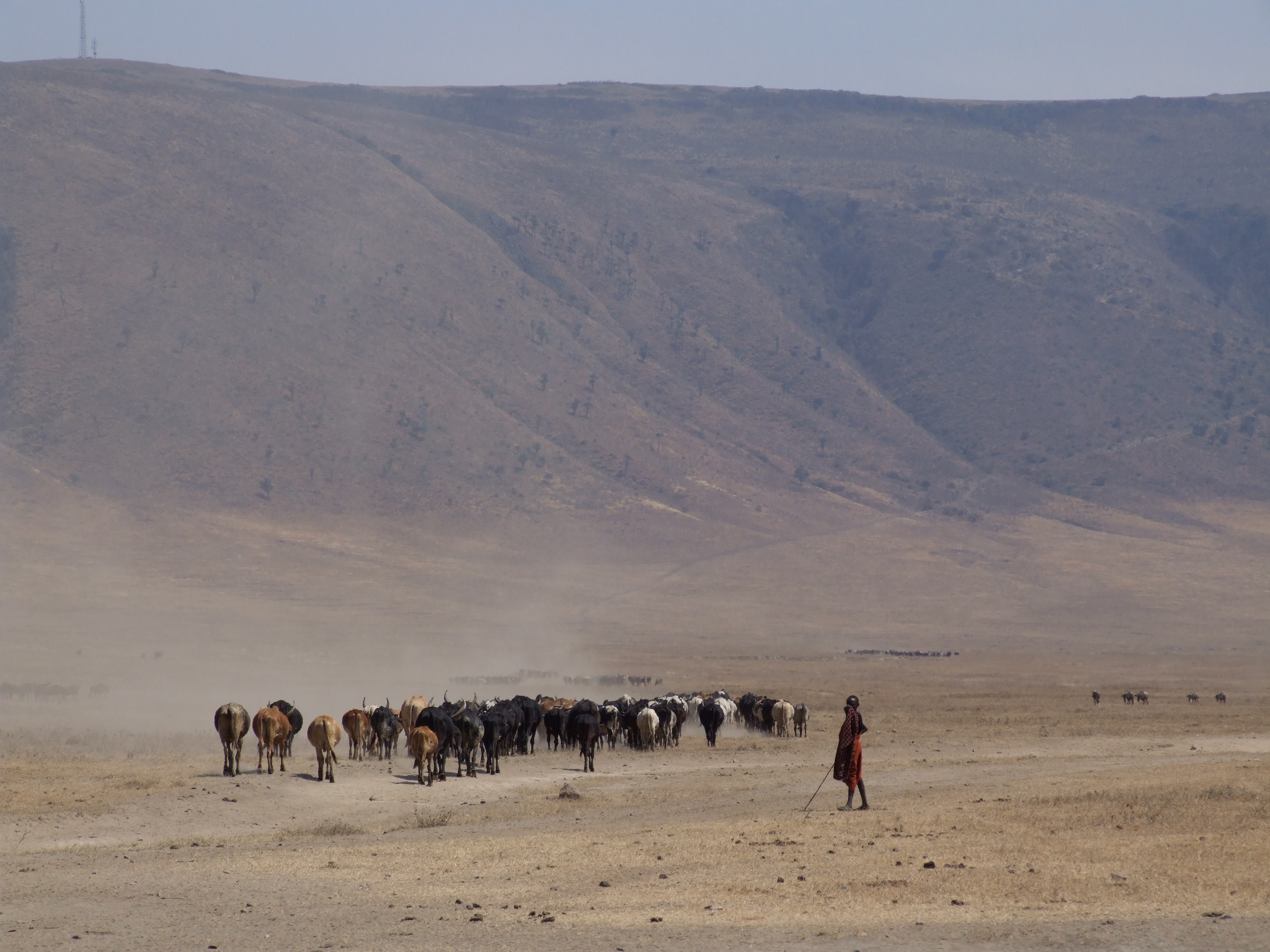
Image courtesy of Nicor (own work) via Wikimedia commons
Tanzania is an intriguing case study for anyone interested in subsistence agriculture and pastoralism, the protection of Indigenous culture, and the challenges posed by conservation parks and eco-tourism in poor countries. The case study is situated around the Ngorongoro conservation area, the world’s largest caldera and an area famed for the abundance of animal species and home to the Maasai ethnic group. The complex dynamics between tourism, agriculture, and conservation allow for research that is truly unique from other case studies.
Though Tanzania shows strong potential for the development of renewable energy sources and increases in agricultural productivity, it remains depedent upon traditional sources of energy (wood) and is a regular net food importer. There is therefore the potential for a variety of projects related to smallholder/subsistence agriculture and renewable energy sources. For the geomatics work, it is expected the focus will be directed at the area South of Ngorongoro crater
Background
Energy/Resources: Biomass Electrical Power in Tanzania
Hydropower: See “Challenges in Small Hydropower Development in Tanzania: Rural electrification Perspective” by Kabaka and Gwang’ombe, 2007
Solar and Wind Potential – See “Distribution of Wind and Solar Energy Resources in Tanzania and Mozambique” by Linus Hammar, 2011
Agriculture: Overview of the Agricultural Sector
Conservation/Ecology: Elephant Management Plan Save Wildlife
Society/Urban: Forest-reliant people and REDD+ in mangroves Tourist attractions and facilities The Ngorongoro Maasai vs. the Government
How Climate Change Affects Women Differently
Basic Geodata
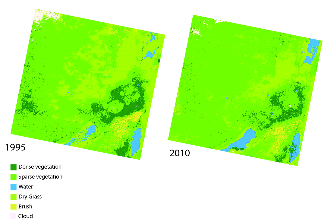
Land cover data (compatible with ArcGIS) will be provided to you in class, covering three past time periods since the 1980s. The links below will show you the approximate boundaries (as seen in Google Earth with recent years), as well as the basic changes in land cover.
view in Google Earth
Remember, in addition to Landsat-derived land cover, there are several more auxiliary geodata sets that have already been collected for you and will be provided in lab. These data include: terrain/elevation, nightlights which represent population, floristic zones, etc. and are available at all study locations. These datasets are introduced and explained further under Additional Data Sources. In addition to these ready-to-go, prepared auxiliary datasets, this page also provides ideas for additional datasets you might find on your own.